Tropical cyclone track forecasting
|
B. Geerts |
2/’02 |
|
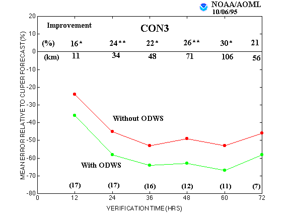
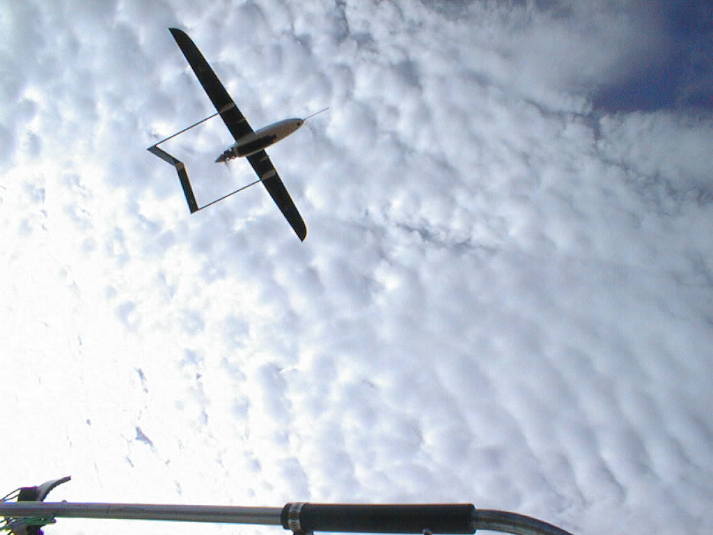
The track of a tropical cyclone is sensitive to small variations in the ambient wind field at all levels in the troposphere, therefore different weather prediction models typically yield broadly divergent tracks. Yet accuracy is of utmost important because serious cyclone damage is typically limited to a small stretch of coastline (50-100 km), and because the approach of a tropical cyclone sets in motion costly emergency procedures. To improve forecasts of Atlantic hurricanes, the US Hurricane Research Division has flown "synoptic flow missions", in which one or more research aircraft deployed a large number of dropwindsondes to define the synoptic-scale flow around hurricanes (1). As rawinsondes, dropwindsondes measure vertical temperature, humidity and wind profiles. Unlike radiosonde balloons, they fall, suspended from a parachute. The added observations specified the "initial condition" more accurately for the computer models so that the errors in the predicted tracks have become about 16-30% smaller (Fig 1). The Australian Bureau of Meteorology has experimented with a less expensive 'aerosonde', a remotely-controlled aircraft that can remain airborne for many hours (2). In 1998 the aerosonde flew in the vicinity of tropical cyclone Tiffany near Port Hedland, West Australia. Another improvement has resulted from ensemble forecasting of tropical cyclones (3). Small errors are introduced in the best-guess initial field. The variables to be perturbed are the cyclone's position, its intensity and the ambient flow (100-500 km from the eye). For instance, the assumed present position can be altered by 50 km in all 4 directions. In the three cases presented in (3), the ensemble provided a good indication of the relative confidence of the best-track forecast. Also, the prognostic track resulting from averaging all perturbations in the ensemble was consistently better than the track based on the best-guess initial field alone. |
Fig 1. The average errors of the Atlantic hurricane track forecasts with and without the dropwindsondes (ODWs), relative to forecast errors from a climatology and persistence model (CLIPER)(-100% implies a perfect forecast). The numbers just above the zero line are the percent improvement of the forecast tracks with ODWs relative to those without. Single and double asterisk superscripts indicate statistical significance at the 95% and 99% levels, respectively. Numbers just below the zero skill line are the average track improvements in kilometers and those in parentheses at the bottom are the number of cases for each forecast interval. (source: (1)). |
References
- Burpee, R. W., J. L. Franklin, S. J. Lord, R. E. Tuleya, and S. D. Aberson, 1996. The impact of omega dropwindsondes on operational hurricane track forecast models. Bull. Amer. Meteor Soc, 77, 925-933.
- G.J. Holland, T. McGeer and H.H. Youngren 1992. Autonomous aerosondes for economical atmospheric soundings anywhere on the globe. Bull. Amer. Meteor Soc, 73, 1987-1999.
- Zhang, Z. and T.N. Krishnamurti, 1997. Ensemble forecasting of hurricane tracks. Bull. Amer. Metor. Soc., 78, 2785-95.