The evolution of frontal systems in association with the movement and evolution of flow patterns in the upper troposphere (the jet stream) applies anywhere, in both latitudes. However large differences exist in the mesoscale structure of fronts, especially cold fronts, and this variation depends at least in part on the regional topography. For instance, cold fronts along the coast of Southeast Australia in summer ('cool change') appear essentially as a gravity current, like a sea breeze, and they are so shallow that they travel around the high terrain of that region (the Snowy Mountains), which is only about 1 to 1.5 km high. The rate of advance of a gravity current is determined by the current's depth and temperature difference (Note 14.D), and usually it is less than the speed of the wind behind the front (1). Which is why the movement of cold fronts is generally determined by synoptic factors (in particular the speed of the Rossby wave aloft).
Surface cold fronts sometimes 'escape' equatorward from their upper-level forcing which decays or travels eastward, especially in Australia and South America. In Mt Isa, Queensland (17ºS) a field experiment was conducted to study the detailed structure of cold fronts in late winter (2). Cold fronts there are always shallow, produce no rain (rarely clouds) and little or no variation occurs above 700 hPa. These are density currents, readily propagating over the flat terrain, especially at night over the surface inversion. Such cold fronts are generally responsible for the southerly morning glories in the Gulf of Carpentaria. (Note 8.L). A frontal passage is part of a deep baroclinic disturbance (Note 13.B) only when the 500 hPa flow is strong, and approximately aligned with the surface front. Clouds and rain are very likely.
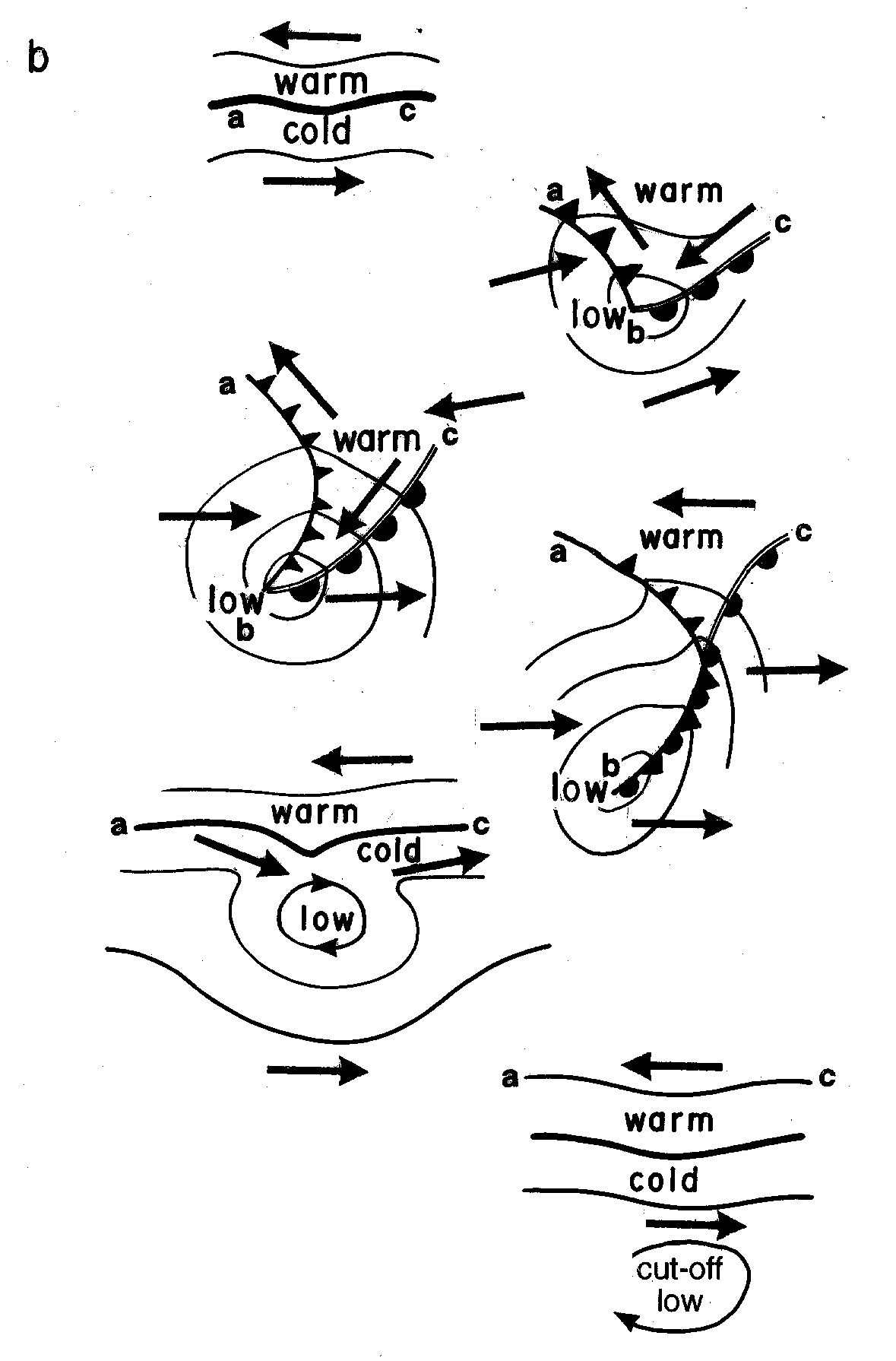
Fig 1. Schematic of the evolution of a frontal disturbance in the southern hemisphere.
The way that polar fronts develop in the southern hemisphere is shown in Fig 1. Subtropical winds converge with polar winds along a temperature boundary which, as it becomes more defined, develops a kink, i.e. the beginning of a frontal disturbance. In a frame of reference moving with this disturbance, the subtropical winds are easterly, the polar winds westerly, and the flow around the disturbance cyclonic, since the weather disturbance is due to the lowering of surface pressure (cyclogenesis). This is because there is a considerable depth of (relatively lightweight) warm air over the disturbance (labeled b in the upper right picture of Fig 1), and a warm column of air produces a lower surface pressure (Note1.G). The disturbance evolves as shown in Fig 1 and in Note 13.B.
A cold front may be preceded by a ‘pre-frontal trough’, which may involve either easterly or westerly winds (3). The main flows near a classical cold front in the southern hemisphere are as shown in Fig. 2.
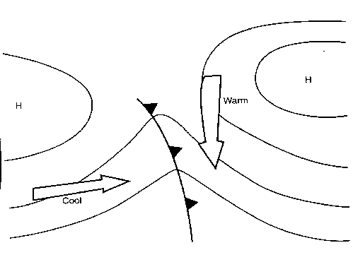
Fig 2. Main flows near the subtropical end of a southern cold front.