|
E. Linacre and B. Geerts |
11/'98 |
Relatively cold air sometimes surges northwards east of the Andes, as explained by Nocera et al (1). These result from displacement of the southeastern Pacific anticyclone onto South America, particularly when there is a trough over the east coast and a ridge over Chile. A large pressure gradient builds up along the Andes, and trapped by the mountains, air from Argentina (sometimes Patagonia) moves towards the equator. Extreme cold surges are known as friagems in Brazil (Section 13.3). There were 46 extreme cold surges during 1882-1994.
Classification
Closer examination of weather maps shows that five types of cold surges can be distinguished, as follows -
The most common types during 1992-6 were 4 and 5, occurring throughout the year. The third type was rare. Types 1 & 2 happened in May - September, the cool season.
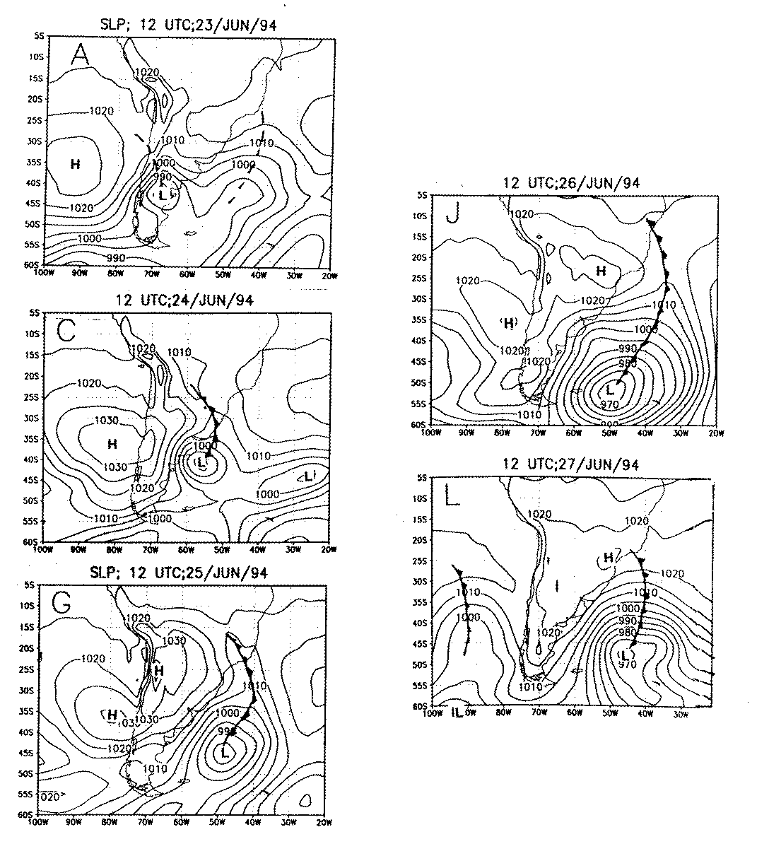
Case study: the friagem of 26 June 1994
A friagem on 26 June 1994 caused record-breaking low minimum temperatures from Buenos Aires to southern Brazil. It damaged the coffee crop to the extent that its price rose by 70% (2). A 5-day sequence of surface charts (Fig 1) shows that this outbreak is a combination of types 2 and 3. A high off Chile crossed the Andes then tracked north to about 25° S, and then east towards the Atlantic. This unusually strong high came in the wake of a frontal low that intensified first in the lee of the Andes (on 23 June) and then over the southwestern Atlantic (on 24-25 June). The strong high and later deep low produced a strong southerly wind, guiding cold air towards the state of Sao Paulo. The cold air advection, followed by radiational cooling on the calm, clear night of 25-26 June, caused widespread frosts.
Fig 1. Synoptic charts for southern South America at Greenwich noon on 23-27 th June 1994 (2).
References