The standardised precipitation index
|
B. Geerts |
3/’02 |
![]()
The standardised precipitation index (SPI) was designed to compare precipitation anomalies across regions with markedly different climates. The SPI is the number of standard deviations that the observed value deviates from the long-term mean, for a normally distributed random variable. Since precipitation is not normally distributed, a transformation is first applied so that the transformed precipitation values follow a normal distribution. Current SPI values for the United States can be viewed here.
Fig 1 compares the 2-year SPI ending in November 1998, following the 1997-1998 El Nino and a wet spell in the Western US, to the 2 year SPI ending February 2002, which was a dry period for the West.
|
|
|
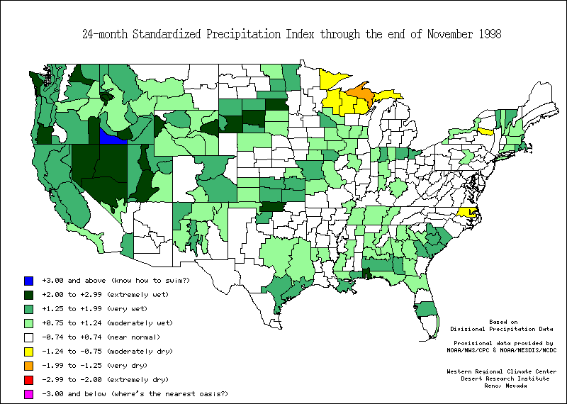
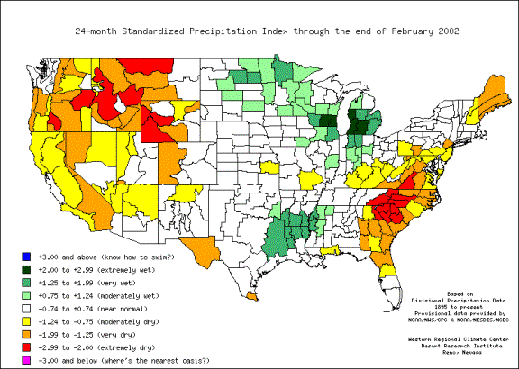
Fig 1. Two-year SPI maps of the USA for Dec ’96 - Nov ’98 (left) and March ’00 – Feb ’02 (right). (Source: Desert Research Institute)
Reference
(1) Edwards, D. C. and T. B. McKee, 1997: Characteristics of 20th century drought in the United States at multiple time scales. Climo Report 97-2, Dept of Atmos Sci, Colorado State University, Fort Collins, CO, May, 155 pp.