|
E. Linacre |
7/'98 |
![]()
Regional and seasonal variations
Brazil is one of the wettest countries in the world, yet the regional variation is large (Fig 1). The country can be divided into five regions, as regards rainfall (1).
Figure 1 shows a 'ridge' of maximum rainfall from northwest to southeast, esp. just south of Brasilia and in Brazil's far south (Parana - Santa Catarina). This is due to the higher topography there (a plateau about 1,000m high), and to the South Atlantic Convergence Zone.
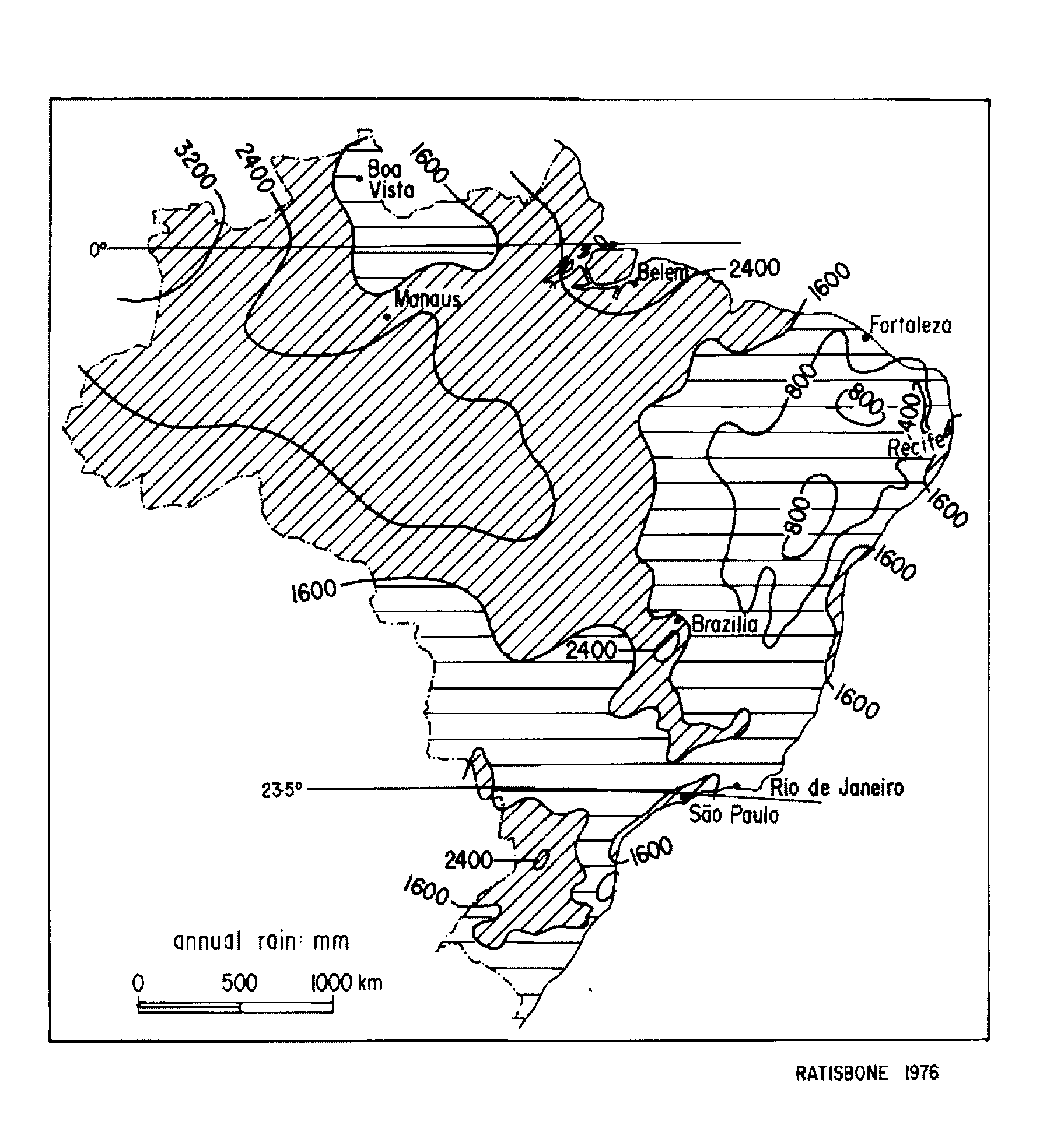
Fig 1. Annual mean rainfall (mm) in Brazil (1).
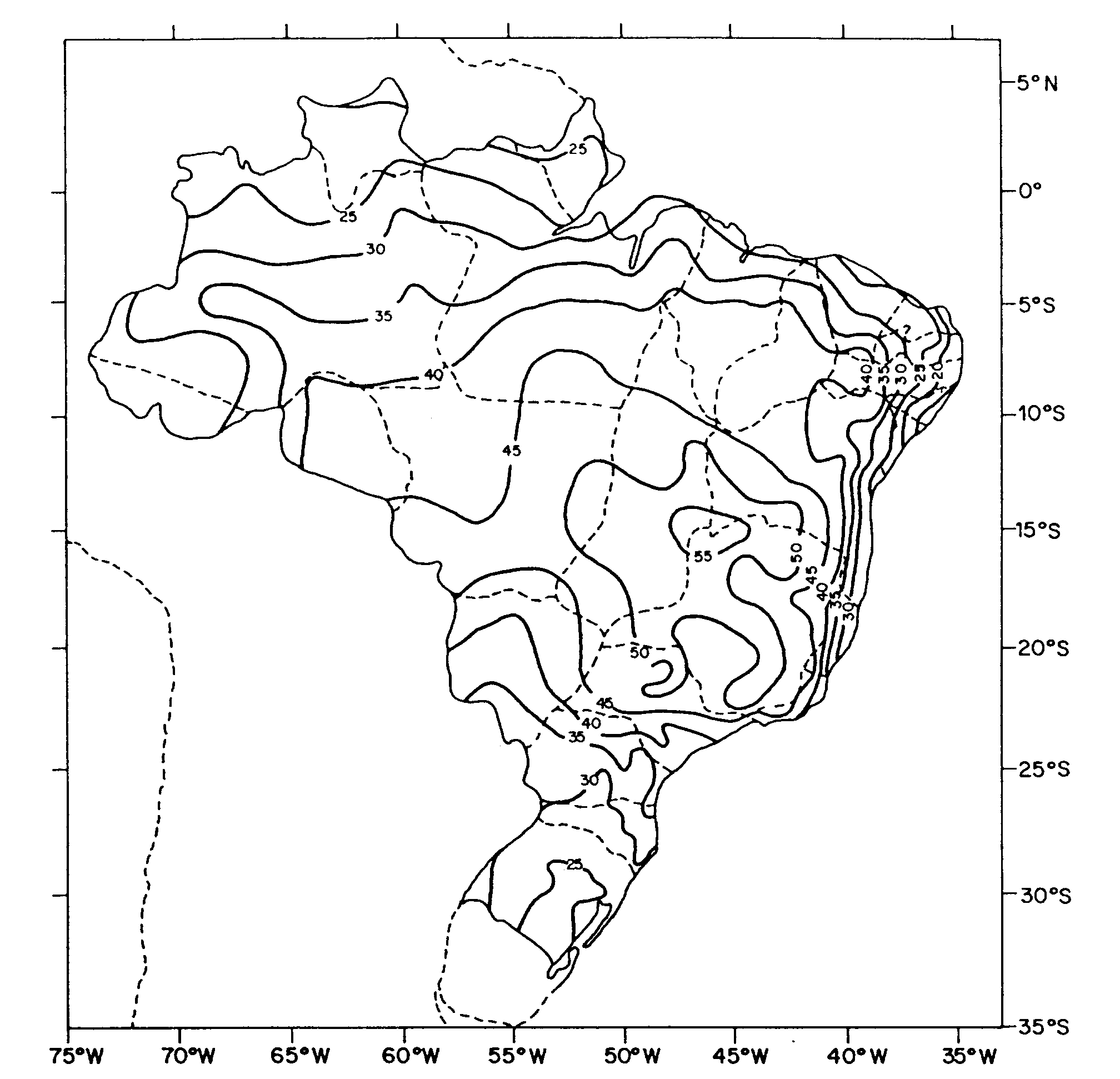
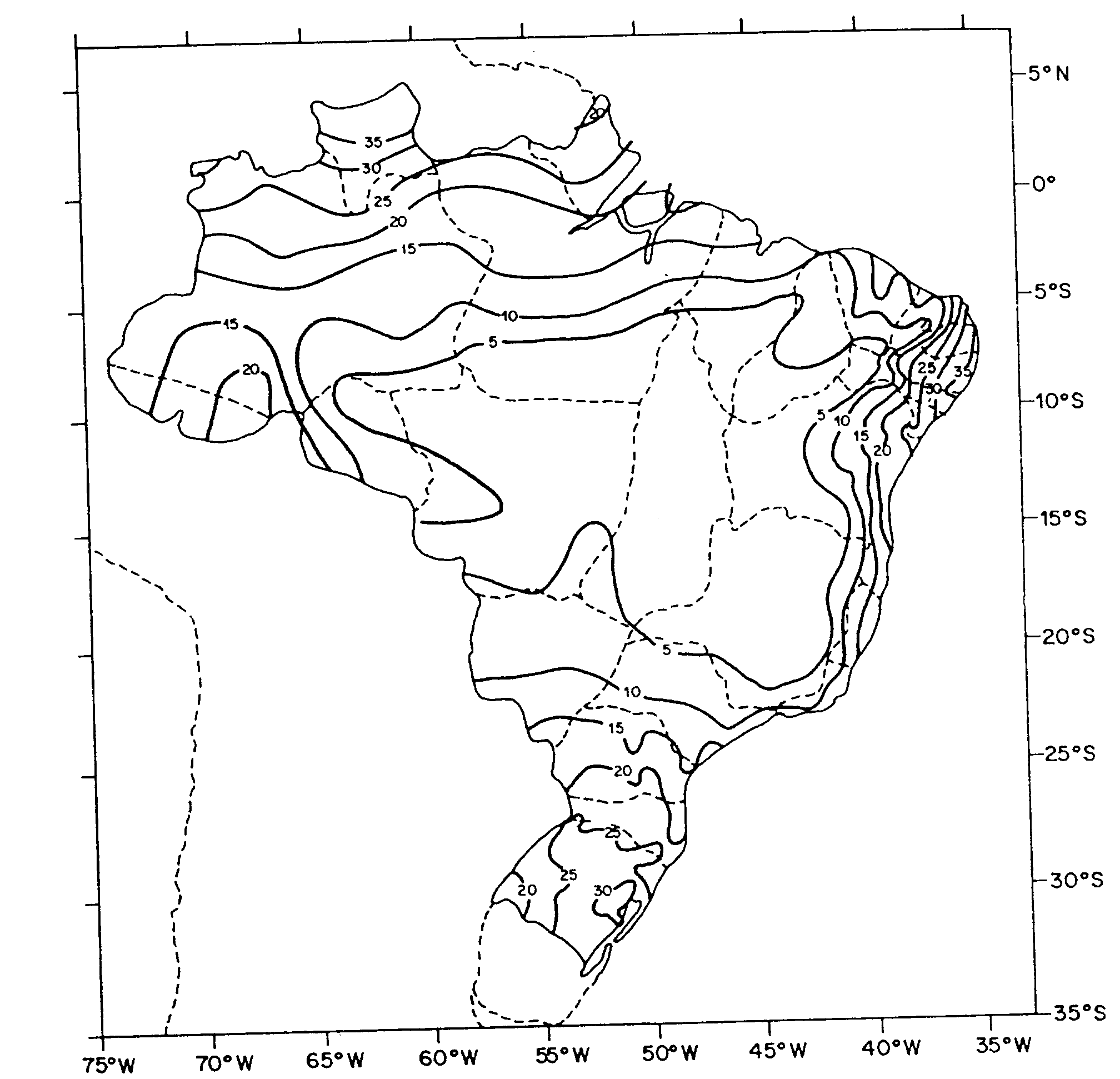
Fig 2. Percentage of the annual total rainfall which falls in a) December - February, and b) June - August (based on1958-78 and 1985-89 data) (2).
Water vapour content and transport
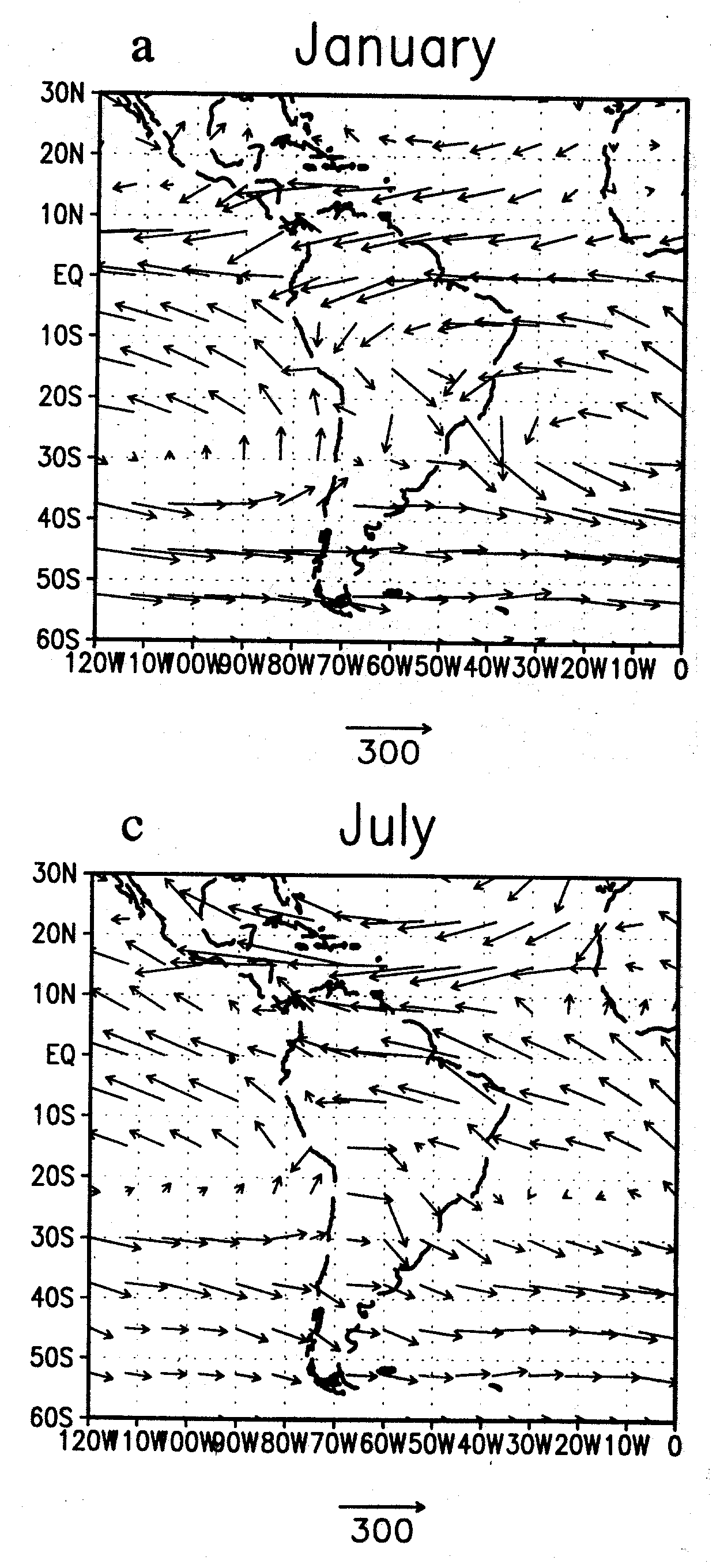
Dewpoint measurements at Brasilia show that the transition from winter to summer conditions occurs within two or three weeks in October and is due to changes in the pattern of winds. The moisture of the summer rain in central Brazil comes largely from the Amazon basin, which in turn receives its moisture from the equatorial Atlantic (Fig 3). There is a broad, large anticyclonic (i.e. anticlockwise) moisture transport belt between the Andes and the South Atlantic high (Fig 4). There is also an appreciable transfer of moisture southeastwards in transient lows south of about 20ºS, especially in July. The moisture transfer at low latitudes is higher than that in midlatitudes where strong westerlies blow, because the mixing ratio is higher in the tropics.
|
Fig 3. The vertically integrated total water vapour transport in summer and winter months in South America. Each arrow has a length proportional to the flux, which is expressed in units of kg/m.s. The arrow below each diagram has a length equivalent to 300 of these units. |
Fig 4: Mean streamlines (lines with arrows) and isotachs (bold lines, units are m/s) in January and July over South America (1). |
The precipitable water over the Amazon Valley is more than 50 kg/m2, equivalent to a depth of 50 mm (Fig 5). These are the highest mean values on Earth; that is the atmosphere over the Amazon typically is moist at all levels, and therefore the lapse rate is nearly moist-adiabatic. The average evaporation rate is 4.5 mm/day, so the average turnover time is 11 days (i.e. 50/4.5). (This resembles times for higher latitudes, where lower temperatures reduce both the evaporation rate and also the precipitable water content of the atmosphere.)
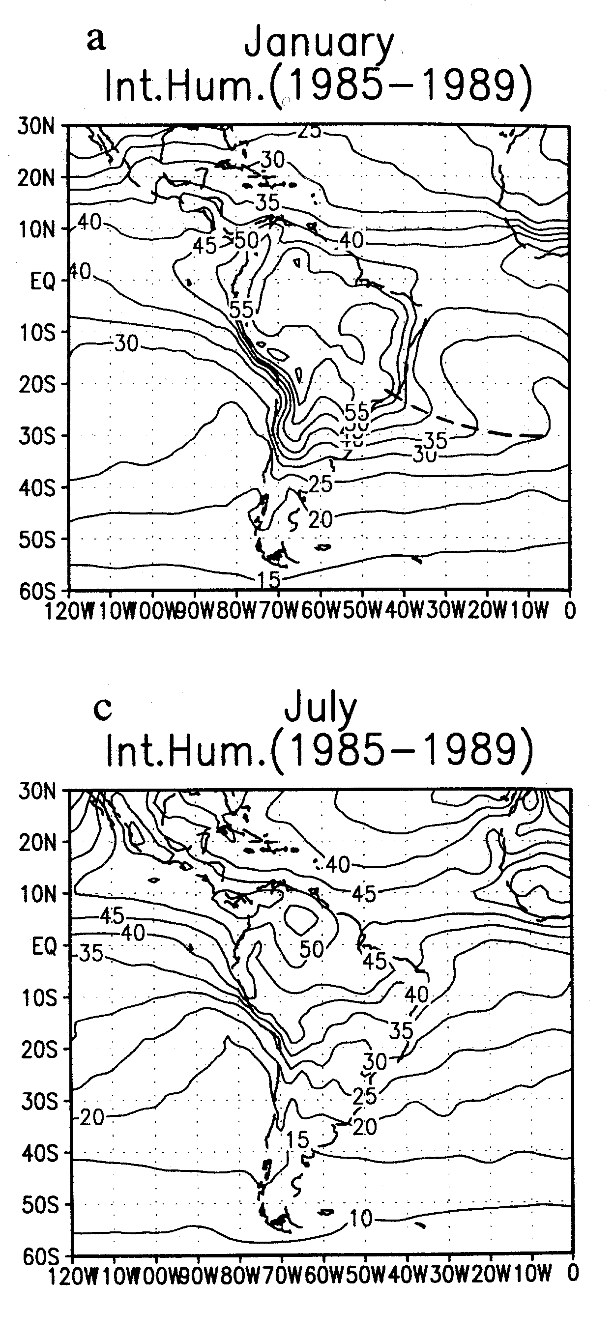
Fig 5. Precipitable water (kg/m2) in January and July (2).
References
(1) Ratisbona, L.R. 1976. The climate of Brazil. In: World Survey of Climatol., 12 (Elsevier) 219-93.
(2) Rao, V.B., I.F.A. Cavalcanti and K. Hada 1996. Annual variation of rainfall over Brazil and water vapour characteristics over South America. J. Geophys. Res., 101, D21, 26,539 - 51.