|
E. Linacre and B. Geerts |
5/'98 |
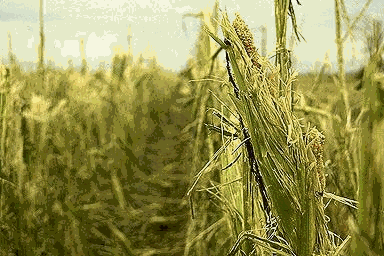
Appearance
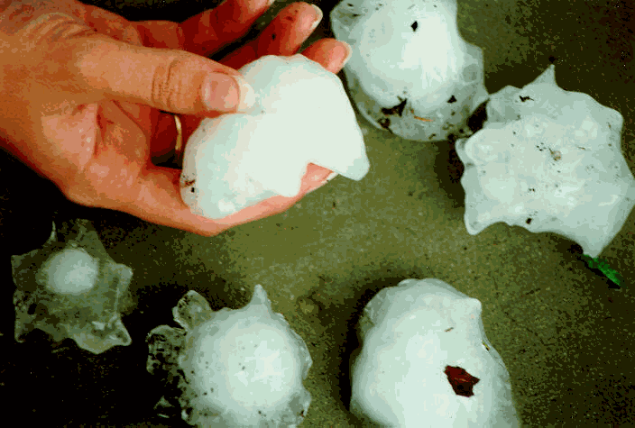
A hailstone often consists of several concentric layers, which are either clear or milky. The milky or frothy ice is the result of the trapping of tiny bubbles. This occurs when the supercooled cloud droplets are small, and the ambient temperature is rather low, so that the droplets freeze instantaneously upon contact with the hailstone. A clear layer is formed when the mean drop size is larger, the liquid water content of the cloud higher, and the ambient temperature higher (yet still below 0° C). In this case the droplets freeze slowly because of their size, allowing trapped air to escape. Sometimes a hailstone will shed water, even when it is still above the freezing level, because the latent heat released when water is frozen makes the hailstone warmer than the environment. The presence of multiple layers indicates that the hailstone was lifted several times by the storm's updrafts, however this 'recycling' appears to be not necessary for the formation of large hailstones.
Fall speed
The terminal velocity (m/s) of hail is estimated as aDb, where D is the hailstone (equivalent) diameter (in mm), and a and b are empirical constants. Measurements indicate that the constant b ranges from 0.5 to 1, i.e. the fallspeed increases less-than-linearly with the hail diameter. One estimate gives a=1.43 and b=0.8 (2, p345). Thus a 1-cm hailstone falls at 9 m/s. A hailstorm which swept through the southwest of Sydney on 18th March 1990 produced hailstones of up to 8 cm in diameter. An 8 cm stone weighs about 0.7 kg and falls at 48 m/s (171 km/h)! It is not surprising then that this hailstorm caused insured damage of over $300 million (1). The largest hailstone ever measured fell in Kansas in September of 1970: it weighed 755 grams, had a diameter of 14 cm, and fell at about 57 m/s (i.e. 207 km/h). This speed is comparable to the highest-ever observed upward airspeed, estimated independently by aircraft and Doppler remote sensors. Many large stones result from the coalescence of smaller stones, as is the case in the picture above.
Occurrence
Kericho in Kenya, which is at 80 km south of the equator and at 2,200 m elevation, holds the record of most frequent hail (132 haildays per year), although large hail is rarely observed at Kericho. Kericho is near the ITCZ year-round. Other factors to explain the high hail frequency are: the orographically-enhanced convection (i.e. thermally driven circulation), the strong uplift of easterly flow over the terrain, and the reduced distance between the freezing level (at about 4.5 km) and the ground; this limits the melting of hail. Large hail (>2 cm in diameter) probably is most common in the central Great Plains of the USA. This is because severe thunderstorms (especially supercells) frequently occur in this area.
Hail is most likely in spring in the USA (Fig 1) and elsewhere.
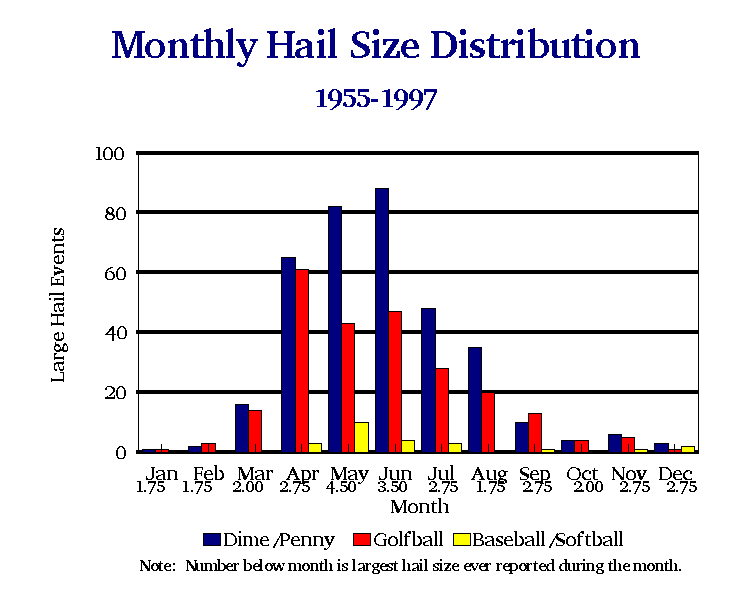
Fig 1. Annual distribution of hail occurrences in the USA, 1955-97. (Source: National Weather Service).
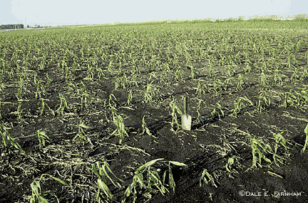
Hail damage and climate change
The question arises - does global warming increase the risk of hail damage (3)? This is not easy to answer, since hail damage is caused by infrequent, intense and sporadic storms. Perhaps some indication might be derived from insurance claims after damage to wheat crops in New South Wales; the crops are particularly susceptible to damage at just the time of year that hailstorms are most common and severe. Records show that there was a significant increase in damage from 1922 to the early 1970's, but subsequently a rapid decrease followed by a steady low incidence. In New South Wales, it appears impossible to detect any consistent effect of global warming from damage statistics at this time.
|
|
|
In the USA, however, a steady upward trend in hail damage seems to occur: between 1955 and 1997, large hail has been reported more frequently (Fig 2). Also, damage fluctuations with periods of 20 years or more have been observed, with peaks in the mid '70s and mid '90s.
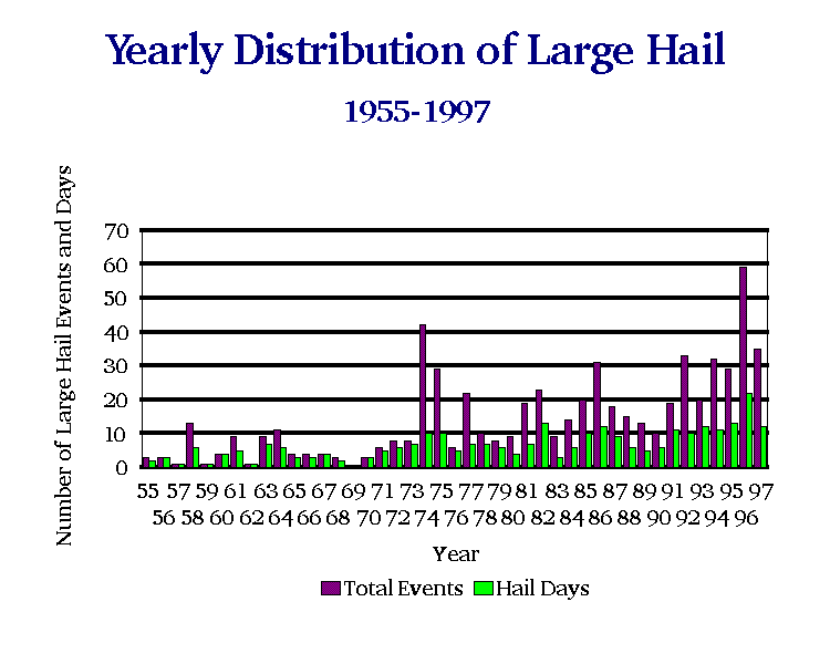
Fig 2. Trend in large hail frequency in the USA, 1955-97 (Source: National Weather Service).
An indirect way of answering the question makes use of an observed correlation between seasonal crop-hail losses and an atmospheric index estimating hail potential. The atmospheric index, the hail index, is based on:
The hail index can be calculated by means of output variables of global climate models. A comparison of typical hail index values in the current climate, to those in a 2xCO2 climate, indicates that there will be little change in the risk of hail damage.
References
(1) Natural Hazards Quarterly (Macquarie University, Sydney) 2, 1.
(2) Pruppacher, H.R. and J.D. Klett, 1978. Microphysics of clouds and precipitation. D. Reidel Publishers, Dordrecht, 714pp.
(3) McMaster, H. 1997. Will the greenhouse effect alter the risk of hail damage? Natural Hazards Quarterly (Macquarie University, Sydney) 3, 1.