|
E. Linacre and B. Geerts |
1/'98 |
![]()
Brazil can be divided into five regions, as regards rainfall (1).
Brasilia (at 15°S, on the interior Central Plateau) is in the third of these regions. Dewpoint measurements show an abrupt rise from around 10°C to about 17°C during September, and a more gradual decline again from March until May. On the other hand, the dewpoint at Manaus (at 3°S in the Amazon basin) remains at about 23°C all year. The precipitable water (Section 6.6) averages around 50 mm, and peaks around 60 mm in October.
Determining the mean air trajectories (Fig 1) and the moisture content of the atmosphere (in terms of precipitable water, Fig 2) allows estimation of the flows of water vapour in different regions and seasons (Fig 3). The winds at 850 hPa height are chiefly governed by an anticyclones over the oceans. In summer there is a trough to the east of the Andes extending from the Amazon basin to about 30°S. This spur of the ITCZ maintains low-level convergence over central Brazil, leading to the summer rain.
The flows of water vapour show that moisture over the Amazon basin comes mainly from the south equatorial Atlantic Ocean, not the Carribean region nor the Pacific. Also, the water-vapour fluxes reveal that a large amount of the Amazon precipitation is due to evapo-transpiration from the Amazon basin, especially during the summer. There the convergence throughout the year is around 1.5 x 10⁻⁵ kg/m2.s, equivalent to a difference between rainfall and evaporation of 473 mm/year. This means an average evaporation of 1727 mm/year (i.e. about 4.7 mm/d) from Amazonia, since the rainfall is about 2200 mm/year.
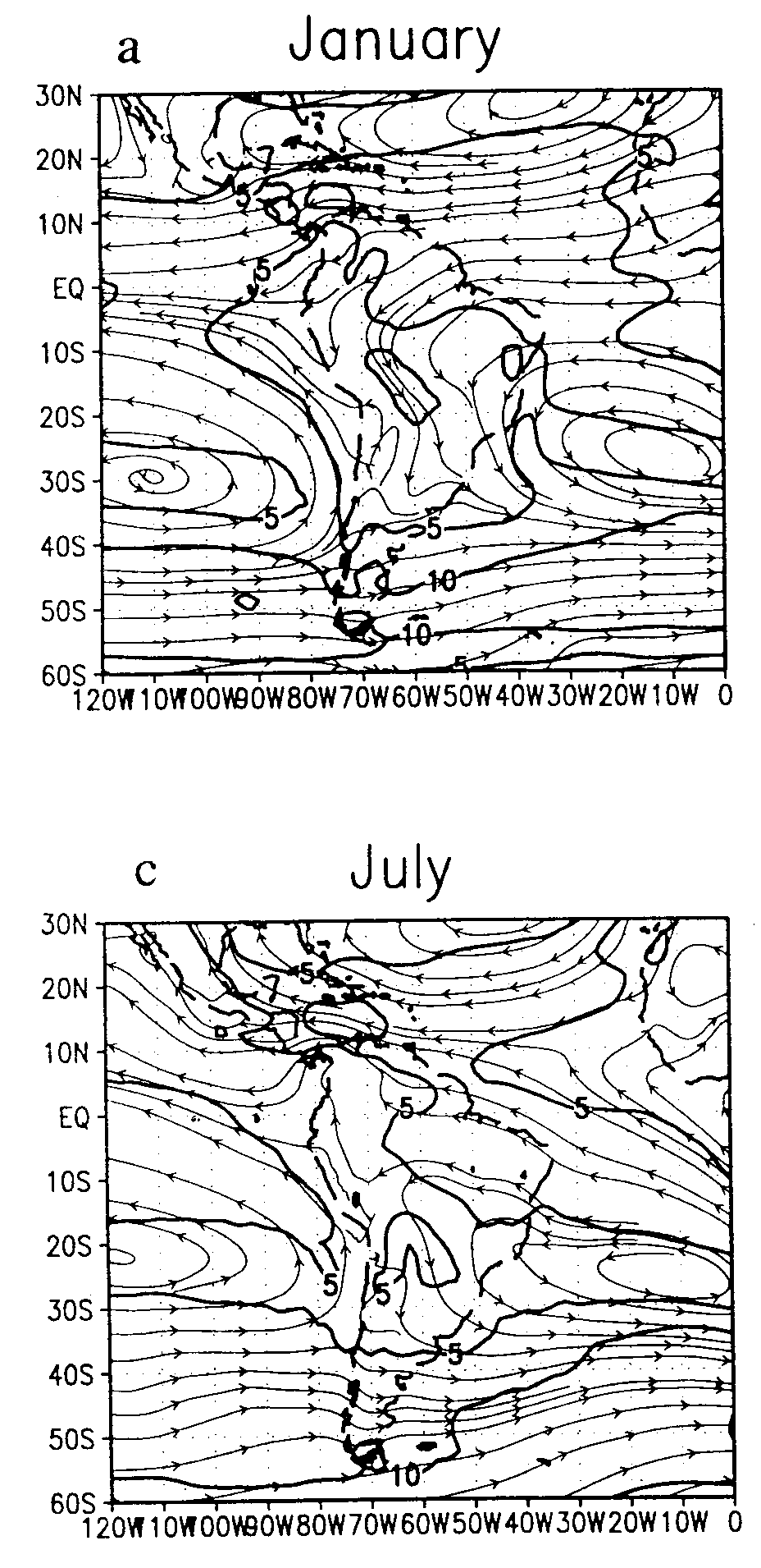
Fig 1: Mean streamlines and isotachs (m/s) in January and July over South America (1).
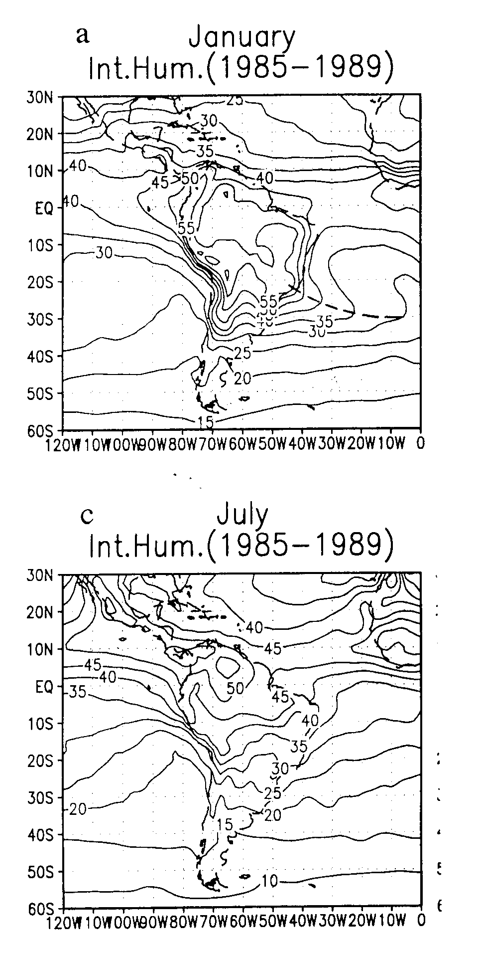
Fig 2: Precipitable water (mm) in January and July over South America (1).
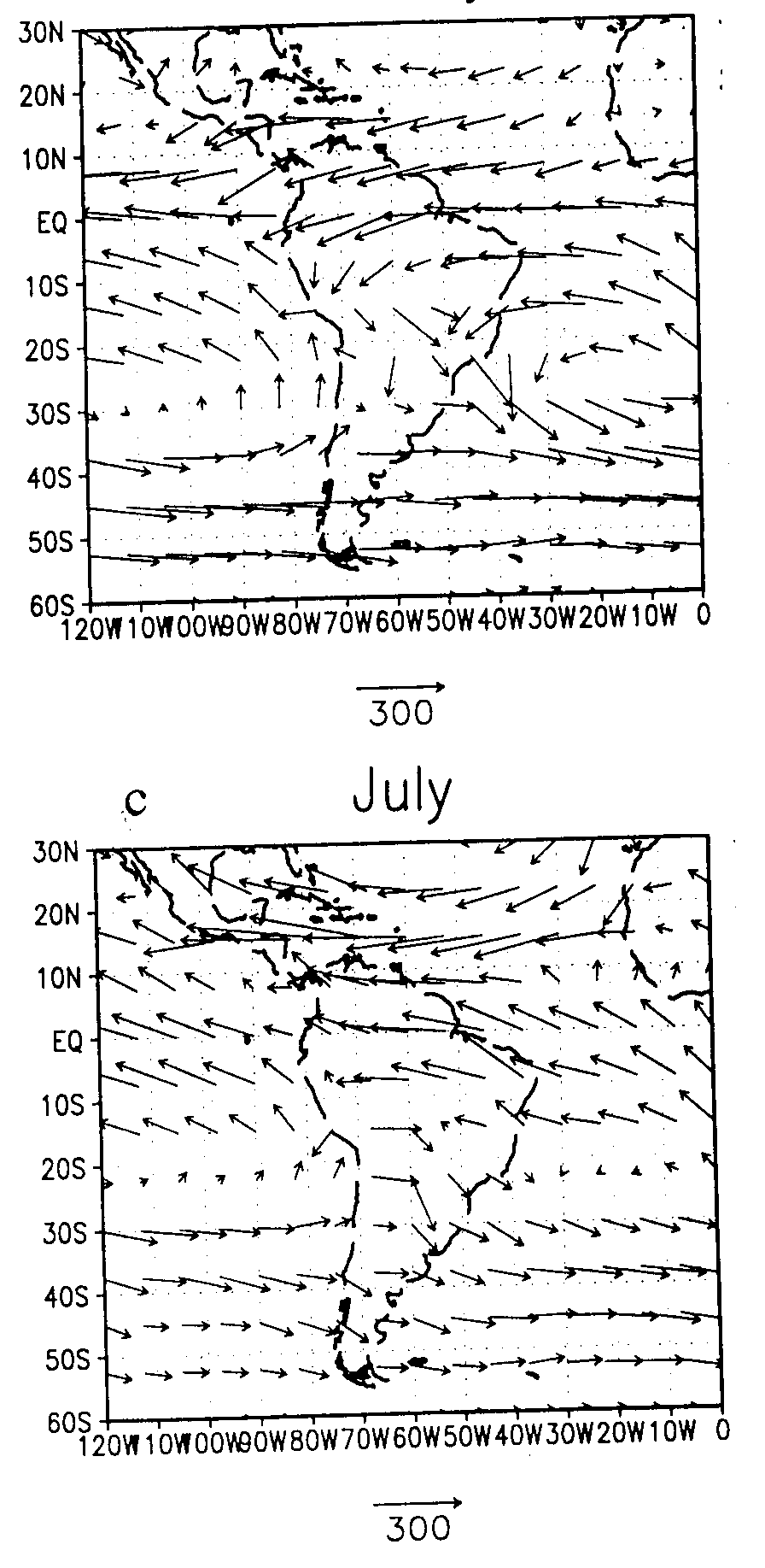
Fig 3: Vertically integrated total vapour transport in January and July over South America (1).
References
(1) Rao, V. Brahmananda, I. F. A. Cavalcanti & K. Hada, 1996: Annual variation of rainfall over Brazil and water vapor characteristics over South America. J. Geophys. Res. 101, 26539-51.